- Item


Location and Size
The district covers a total surface area of about 1217.7 square kilometers (472.4 sq miles) which form about five percent (5%) of the total area of the Ashanti Region, and 0.5 percent of the total area of the country. The built environment consists of 369.482 square kilometers with the natural environment forming 848.218 square kilometers of the total land area.
The District also shares common boundaries on the North and North-West with Asante Akim North District and Kwahu South District on the West. On the South-West lies Amansie East District and on the South-East is Birim North District in the Eastern Region.
The District has a location advantage as being the “Gateway to Ashanti” offers a lot of marketing potentials that can foster its development from the national capital, Accra. Its location on the Accra-Kumasi road exposes it to the potential investors, travellers and tourists entering the region. The district can be found in the forest zone in Ghana and that, the forest serves as a means of improving the climate which help agricultural production. Moreover, the district is known for its agrarian nature which is a major source of employment and offers large production of foodstuffs for most people in and outside the District. Its location is an advantage for most travellers along the Accra Kumasi highways. This is because, most travellers buy foodstuffs to their various destinations. This serves as a source of ready market for the farmers. This also goes a long way to add to the nations’ revenue and thus, national development.
Issues
• Strategically location for investment opportunities
• Large market for commerce
• Wildlife and land Conservation
Topography and Drainage
The relief of the District is generally undulating with few hilly areas. The elevation of the low-lying areas adjacent to the hills is between 200 and 300 meters above the sea level. The Kwahu-Mampong-Kintampo ridge which rises to about 500meters passes through the district. It rises to about 450 meters in some places.
There are three main rivers, which drain the district, namely Pra, Kume and Subin Rivers. Additionally, there are a number of perennial and seasonal streams in the district. River Pra flows along the eastern border and also forms the boundary between the Ashanti Region and the Eastern Region. Human activities along most of these water bodies are reducing their sizes which affect farming activities.
The relief and drainage supports farmers in irrigating their food crops during the dry seasons. The existence of several streams/water bodies in the District enhances irrigation and will therefore promote all year round farming making food available in the District. The beautiful nature of the hills give a development green light which when value is added to will improve tourism and add to revenue, thus improving on the general development of the district. Furthermore streams found in the district provide sources of water for domestic use.
Climate
In conformity with other parts of the region, the district has uniformly high temperature throughout the year. The district records a maximum temperature of about 30ºC in March and April. The minimum temperature of about 26ºC is recorded in August, the coolest month of the year. The mean monthly temperature is about 33ºC. The temperature range supports agricultural production. The District experiences a double maxima rainfall. The major rainy season usually occurs between April and June. It reaches its peak in July. The minor season occurs between September through to the end of November. The mean annual rainfall ranges between 1500mm and 1700mm.
The double maxima rainfall supports two cropping seasons making food available throughout all the year in the District and even outside the district. The rainfall pattern and adequate sunshine supports the crops like citrus, cocoa, oil palm, cassava, plantain and coffee among others. However, for the past three years, the rainfall pattern has changed. Mean annual rainfall has reduced to between 1020mm-1132mm. This has impacted negatively on Agricultural production since agriculture is mostly rain fed. Food crop farmers do not get enough rainfall to support all year farming.
Some areas in the drainage basins are exposed to flooding due to several factors which include filling of existing waterways and low-lying areas, illegal construction of buildings in waterways, reduction in flow capacity of channels due to siltation, illegal mining, overgrown-vegetation and accumulation of solid waste, and general lack of maintenance of the drainage infrastructure.
Issues
• Filling of existing waterways
• Siltation leading to limited capacity of flow
• Overgrown vegetation in storm drains
• Develop ecotourism to generate income opportunities for the local
• Inadequate maintenance of drain infrastructure
• Inadequate architectural designs to conform to the topography
• Aesthetic view of the district
Vegetation
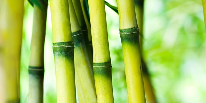
The Asante Akim-South district falls within the moist semi-deciduous forest region where different species of tropical hard woods with high economic value are located. Most of the trees in this forest remain ever green throughout the year in the district based on the climatic factors in the District. The types of trees found in the district include; Wawa, Onyina, Mahogany, Asanfena and Dahoma.
Currently, the district has four forest reserves which cover a total area of about 109.6 sq km include, Formangsu, Prakow, Domi River and Mirasa Hills. Significant portion of the depleted forest has been allocated to farmers since 2003 as “Taungya” for farming activities. This situation has increased farming activities and has also increased food crop production in the district.
The massive depletion of the forest by timber operators implies that, a continuous felling of trees will negatively affect the rainfall situation or a reduction of the level of water bodies within the district which supports irrigation for farming, thus reduction in farming production.
Geology
The Asante Akim South Municipal is underlain by two major geological formations. These are from mainly Dahomeyan and Birrimean origin and are basically phyllites granites and Tarkwaian sandstones over which the soils are developed .The phyllites consist of the Upper and Lower Birrimean rocks. The Upper Birrimean rocks consists of charts metamorphosed lava and tuffs; grewacke and epidorite. The lower Birrimean rocks consist of phyllites, grewackes, schists and gnesis.
Outcrops of granite rocks extend from Yawkwei through Juaso, Obogu, and Banso. Currently, two companies are extracting granite chippings for the construction of road throughout the country. There still exists deposit of granite rocks calling for quarry investment. Gold are being prospected at Bankame, Banso and Dwendwenase area. Mining is being done at Banka. The mineral deposits are not exploited in large scale. However, there is the existence of illegal galamsey operators in the District. The activities of these illegal mining operators pose serious threat to the environment.
Granite rock serves as building material which can be used for all forms of constructional activities such as construction works such as school buildings, drains in the District and even outside the District. Mining and quarrying activities have created employment for the unemployed. For example the presence of chipping companies in the district can help reduce the high unemployment situation in the district. The mining and quarrying activities are major sources of revenue for the District. However, most of these sites have been encroached by private residential accommodation making it dangerous for mining of the stones for construction purposes.
There is the need for the Town and Country Planning Department to clearly demarcate the places that are yet to be developed and create buffers to prevent the development of residential and other industrial properties close to the sites for stone mining.
Issues
• Encroachment of land
• Creation of buffer
• Stone mining
• Soil testing before development
• Expensive to cultivate in some areas
• Gold mining
Soils and their Suitability for Agriculture
The district falls within the forest ochrosols and oxysols which are made up of sandy loam and clayey loam compositions respectively which are well drained and very fertile. The soil type is associated with the forest zone in which the district falls within. The soils in the District are grouped into eight types with their suitability for Agriculture in the District. These include the following:
Wiawso-Shi Association: These soils, which are developed on the Upper Birrimian rocks, are very well to moderately well drained, highly gravely, concretionary, and medium to fine textured. The upland and lower slopes are suitable for food crops like maize, plantain, cocoyam and cassava, and marginally good for tree crops such as coffee, cocoa, citrus and oil palm.
Atukrom-Asikuma Association: Soils in this association are medium textured, moderately well drained, gravely, concretionary and susceptible to very severe erosion. The upland soils are recommended for tree crops and forestry while the lowlands soils are suitable for sugarcane and vegetables. These soils are developed over the Upper Birrimian rocks and can be found in settlements like Dampong and Asuboa.
Bekwai-Oda Compound Association: This soil association has developed over Lower Birrimian rocks. It is generally medium textured, slight to moderately susceptible to erosion, well to moderately well drained, deep and non-gravely. Its upland slopes are recommended for tree crops and the lowland and valley bottom soils are suitable for rice, sugarcane and vegetables. Banka, Tokwai and Gyadam are among settlements with this type of soil association.
Kumasi-Offinso Compound Association: This soil association develops over the Cape Coast granite. It is generally medium to coarse textured, good structured, moderately gravely, stony and concretionary. It occurs on undulating topography with moderate to severe susceptibility to erosion. Its upland slopes soils are good for both tree and food crops. The Lowland and valley bottom soils are suitable for rice, sugarcane and vegetables. Settlements with this type of soil include Obogu, Amantia, Muronaim, Breku, Banso and Bankame.
Swedru-Nsaba Simple Association: The surface layers of this association are usually neutral or even slightly alkaline and may even be somewhat calcareous. However, the reactions fall with soils deep down. The soils are suitable for arable crops and tree crops, especially cocoa. Areas around Banka are having this type of soil.
Adujanso-Bechem Association: Soils of this association are generally deep, coarse to medium textured. They are well to moderately well drained and concretionary with low nutrient reserves. They are suitable for both food and tree crops. Just a small pocket of this type of soil is found in the district around Breku and its environs.
Juaso-Morso Association: This association develops over Tarkwaian rocks. The texture of this soil association is generally medium, highly to moderately gravely, or deep and non-gravely, and well to moderately well drained. They occur on gently undulating topography with relatively slight to moderate susceptibility to erosion. Tree crops thrive well in its upland slope soils while the lowlands soils are suitable for rice, sugarcane and vegetables. Juaso, Ofoase, Kumeso and Teshie Praso are settlements with this type of soil association.
Awaham-Kakum – Chichiwere Association: They develop over alluvial deposits. Major soils of this association are coarse to medium textured, well to moderately well drained, deep to very deep and generally non-gravely. They occur extensively on low-lying, almost flat alluvial terrace.
Most of the soil types in the district are highly favourable for Agriculture Production. Food crops and other cash crops are made available in the district as almost all the soil type support the Production of these crops. Increase in production of these crops will promote export which will generate revenue for the district as soil types in the District serve as a great potential in increasing agriculture production.
The Natural Environment
The natural environment of the district consist of land available for farming, forest reserves and other natural land available for development, basically forestry which is also one of the important sectors of the district. The district has six major forest reserves, which are all rich in wildlife and lumber. They include the North and South Formansu Forest Reserves, Domi River Reserve, Prakaw Forest Reserve, Bobiri Forest Reserve and Bandai Hills Forest Reserve. They consist of different species of tropical hardwood of high economic-value trees like odum, mahogany, edinam and wawa. The presence of the forest reserves has made lumbering an important economic activity in the district.
Improper management of the forest and the forest reserves has posed a serious environmental problem. The causes of the depletion of the forests among others include encroachment of forest reserves by illegal chainsaw operators whose activities, if not checked, could deprive the district of the needed forest resources for development. Already, the North and South Formansu Forest Reserves have been depleted of tree species of commercial importance.
Frequent outbreak of bushfires during the dry season has also contributed to the depletion of forests and other forms of environmental degradation in the district. Most of the known wildlife such as the black ducker, the deer and monkeys, which were mostly found in the forest, now face extinction. Another cause of the depletion of the natural environment is due to the bad farming practices through bush burning and improper fertilizer application. It is however importance to introduce modern farming techniques likes the use of weedicide and proper ways of using fertilizer in order not to degrade the environment.
Efforts to control these operators had not been successful. It is now obvious that, there is a reduction of the mean annual rainfall to between 1020mm-1132mm instead of 1500mm to 1700mm. This has impacted negatively on Agricultural production since the district needs rainfall to support its activities which serves as a major source of employment to about 70 percent of the populace. The depletion will also not help to get enough raw materials for development activities if the need arises.
The Forestry Service Commission has therefore drawn up a re-afforestation programme under which areas affected by bushfires are given to farmers for farming while the Service plants trees in the farms. It has also supplied teak seedlings to individual farmers who have gone into teak plantation. More importantly, the Forestry Service Commission and the District Assembly should initiate a more intensive afforestation programme to preserve some of the important economic tree species to ensure ecological balance in the district. Though the forest is deemed a major source of revenue to the district, especially the traditional leaders, it is also expedient that sustainable measures should be inculcated in order to ensure sustenance of the value of the natural environment and its effect on the built environment.
Land under Cultivation
The total land area outside the built environment is estimated at 848,218 sq. km. As shown in Table 1.2 below, the use of this land can be divided into food crop farming, tree crop farming, fallow and forestry land uses. About 75% is under crop cultivation, comprising of food crop farms (33.91%) and tree crop farms (41.55%). This is followed by forestry (0.14%) and fallow (24.4%). This implies that there is adequate land in the district to expand and diversify agricultural production. However, to ensure sustainable development, there is the need to promote the adoption of more efficient and environmentally friendly farming methods and practices like the use manure and fertilizer in order not to deplete the land for cultivation and thus ensure sustainable use of agricultural lands other than encroaching on forestry lands.
The Built Environment
The activities of the populace living within and outside the district do not only affect the natural environment but also manifest in the built environment, that is, the portion of the district where human beings live. More importantly, it is an undeniable fact that, the natural environment is affected by the activities from the built environment and vice versa. The built environment highlights on the way of life of the people, in terms of shelter, living conditions and practices that have direct bearing on the environment (i.e. both the built and the natural environment).
IMPLICATIONS FOR DEVELOPMENT - PHYSICAL AND NATURAL ENVIRONMENT
The levels of interactions among the various features and characteristics show both positive and negative developmental implication. The following are the implications derived from the physical and natural environment in the district.
- The district abounds in natural resources such as mineral deposits, rock and hilly formations which are suitable for quarrying and constructional works. These materials can help in renovating and constructing of new roads and public buildings like KVIP, Community centre, schools and others.
- The presence of the quarry and other mining materials can serve as a source of revenue to the district to support developmental projects.
- The favorable climatic and relief as well as vegetation attract more people into the district to do farming, quarrying, mining, lumbering and other activities
- The poor housing condition in terms of exposed foundation and cracked walls are threat to life and property and should be given immediate attention
Land Management/Land Tenure System
Land acquisition in the district is through four (4) sources; Stool, family/inheritance, leasehold and sharecropping. Allocation of plots for building and commercial purposes is vested in the stool. For agricultural purposes, inheritance accounts for 68% of land holdings in the district. Share cropping and leasehold account for 21.5% and 11% respectively. This has created a problem of land fragmentation which does not encourage large-scale commercial venture.
Condition of Walls
The type of building materials determines the quality of the building. Even though the dominant building material in the district is sand Crete which is a quality building material, 48.3 percent of the houses have their walls cracked. These cracked walls are those built with wattle and daub and other local materials. The district has sand and quarry which can be used for building houses. The cracked walls imply that, those buildings pose the risk of collapsing and thus causing harm to life and property.
Condition of Foundation of Houses
From a sample survey conducted by the DPCU, 44.8 percent of the houses in the district are having their foundation exposed. This exposed foundation is attributed to poor drainage condition in most of the communities in the district. Thus, there is the risk of buildings being collapsed due to weak foundation. This calls for the need to improve the drainage systems to reduce the impact of erosion on the built environment and also encourage proper landscaping.
Nature of Drains
The nature of drains in the district is mostly trenches which are found behind houses and u- shape drains of which most of them were choked and cracked. Observation made during a survey shows that 95 percent of the drains were choked with garbage which is attributed to the poor sanitary condition of most communities within the district.
The implication of this phenomenon is that, the existence of stagnant water in choked trenches and gutters serves as breeding grounds for mosquitoes which cause outbreak of various diseases like malaria, cholera and related diseases in the district. Possible flooding is also another implication of this situation when there is any heavy and continuous downpour.
Date Created : 11/21/2017 8:11:35 AM


Local Gov Ministry
Int of Local Gov Studies
Ministry of Information
Local Gov Service
Ghana MPs
Ghana Hospitals
NALAG
 facebook
 twitter
 Youtube
 +233 593 831 280
+233 20 230 9497
+233 593 831 280
+233 20 230 9497 0800 430 430
 GPS: GE-231-4383
 info@ghanadistricts.com
 Box GP1044, Accra, Ghana