- Item


Navrongo is the capital of Kassena Nankana, has been one of the most important historical and commercial cities of the Upper East Region and Ghana at large. Known as the Cape Coast of the North, it was the first place of settlement of the missionaries in the northern sector and the start of both the Christian religion and formal education. For years, it has been the traditional and commercial capital of the people of Navrongo and its immediate environs.
It is currently the major commercial town in Municipality. Navrongo seats the administration and staff of the Assembly as well as the headquarters of almost all the governmental and non¬governmental departments and agencies operating in the municipality. It is also the seat of the Navro-pio, the traditional over lord of Navrongo. It is the most densely populated town with a population of 15,983 (2000 PHC).
Natural Landscape
The Municipality is generally low-lying. The landscape is generally undulating with isolated hills rising up to about 300 metres in the western and southern parts.
Location & Size:
The Kassena-Nankana lies within the Guinea Savannah woodlands.It falls approximately between latitude 11°10’ and 10°3’ North and longitude 10°1’ West. It is one of the thirteen (13) districts in the Upper East Region of the Republic of Ghana.
The Municipality has a total land area of about 1,674 sq.km and stretches about 55km North-South and 53km East-West. It shares boundaries to the North with Burkina Faso, to the East with Bongo and Bolgatanga , West with the Builsa District and Sissala District (in the Upper West Region) and South with West Mamprusi District (in the Northern Region). It has a total of 216 communities.
Topology & Drainage
The topography is low-lying with an average height of 100 metres above sea level. The terrain is undulating with isolated hills dotting the landscape.
Is generally low-lying. The landscape is generally undulating with isolated hills rising up to about 300 metres in the western parts of the Municipality. Notably among these hills include Fie (280 metres), Busono (350 metres) and Zambao (360 metres).
The drainage system is constituted mainly around the tributaries of the Sissili River – Asibelika, Afumbeli, Bukpegi and Beeyi. A tributary of the Asibelika River (Tono River) has been dammed to provide irrigation facilities, which is of great economic importance to the entire Municipality. There are some few dugouts and ponds, which are used for livestock, crop farming and domestic purposes.
Climate & Vegetation
The vegetation of the municipality is of the Sudan and savannah type with grassland separating deciduous trees. It coveres mainly by the Sahel and Sudan-Savannah types of vegetations; comprising open savannah with fire-swept grassland and deciduous trees.
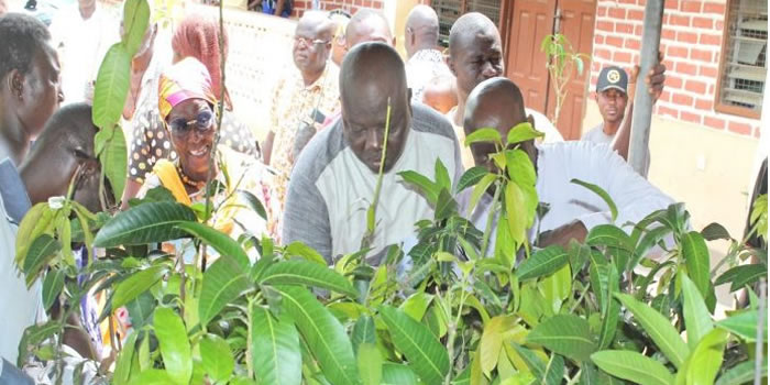
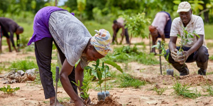
Some of the most densely vegetated parts can be found along river basins and forest reserves. Examples are the Sissili and Asibelika basins, Kologo and Naaga forest reserves. Most of these trees in the forest areas shed off their leaves during the dry season.
However, the activities of man over the years have affected the original (virgin) vegetation cover. Common trees found are dawadawa, baobab, sheanut and mangos. The climate conditions are characterized by the dry and wet seasons, which are influenced mainly by two (2) air masses – the North-East Trade winds and the South-Westerlies (Tropical Maritime).
The Harmattan air mass (North-East Trade Winds) is usually dry and dusty as it originates from the Sahara Desert. During such periods, rainfall is virtually absent due to low relative humidity, which rarely exceeds 20 per cent and low vapour pressure less than 10mb.
Day temperatures are high recording 42° Celsius (especially February and March) and night temperatures are as low as 18° Celsius.It experiences the tropical maritime air mass between May and October. This brings rainfall averaging 950mm per annum.
The Municipality is covered mainly by the Sahel and Sudan-Savannah types of vegetations; comprising open savannah with fire-swept grassland and deciduous trees. Some of the most densely vegetated parts can be found along river basins and forest reserves. Examples are the Sissili and Asibelika basins, Kologo and Naaga forest reserves. Most of these trees in the forest areas shed off their leaves during the dry season.
Geology & Soil
The geology comprises granite and shale, althouth the rock formations are actually of a diverse nature.Two main types of soil are present within the Municipality namely the Savannah ochrosols and groundwater laterite. The northern and eastern parts are covered by the Savannah ochrosols, while the rest has groundwater laterite.
The Savannah ochrosols are porous, well drained, loamy, mildly acidic and interspersed with patches of black or dark-grey clay soils. This soil type is suitable for cultivation and hence accounts for the arable land sites including most parts of the Tono Irrigation Project sites where both wet and dry season farming activities are concentrated.
The groundwater laterites are developed mainly over shale and granite and covers approximately 60 per cent of land area. Due to the underlying rock type (granite), they become waterlogged during the rainy season and dry out during the dry season, thus causing cemented layers of iron-stone (hard pan), which makes cultivation difficult.
Date Created : 11/20/2017 7:38:04 AM


Local Gov Ministry
Int of Local Gov Studies
Ministry of Information
Local Gov Service
Ghana MPs
Ghana Hospitals
NALAG
 facebook
 twitter
 Youtube
 +233 593 831 280
+233 20 230 9497
+233 593 831 280
+233 20 230 9497 0800 430 430
 GPS: GE-231-4383
 info@ghanadistricts.com
 Box GP1044, Accra, Ghana