- Item


Physical and Natural Environment
Location and Size
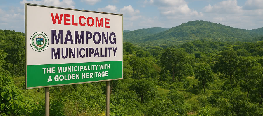
The Mampong Municipal Assembly is among the 43 Metropolitan, Municipal and MunicipalAssemblies in the Ashanti Region of Ghana. It is bounded to the South by Sekyere South Municipal (Agona), the East by Sekyere Central (Nsuta) and the North by Sekyere-Dumasi (Ejura) Municipal. The Municipal capital, Mampong is 52km away from the regional capital, Kumasi. Mampong is also the seat of the second most important stool in the Ashanti Kingdom:
The Silver Stool. The Municipal area forms about 2.2% of the total land size of the Ashanti region. The major towns within the municipality are Mampong, Kofiase, Asaam, Kofiase, Adidwan, Yonso, Nkwanta, and Apaah, It is also located on longitudes 0.05 degrees and 1.30 degrees west and latitudes 6.55 degrees and 7.30 degrees north, covering a total land area of 449km2 .
The Municipality has 79 settlements with about 55% being rural and 45% forming the urban enclave. The rural areas are mostly found in the northern part of the municipality where communities with less than fifty (50) people are dispersed.
Source: Mampong Municipal Assembly, Physical Planning, 2021.
Figure 2: Settlement Map of Mampong
Source: Mampong Municipal Assembly, Physical Planning, 2021.
Biodiversity, Climate Change, Green Economy and Environment
Biodiversity
The built environment within the municipality can be categorized into two; those in the urban areas and those in the rural areas. In the urban areas, settlement patterns are usually nucleated with very high population densities. Towns like Mampong, Kofiase, Asaam, Benim, Ninting and Adidwan have well-prepared town layouts depicting land use patterns such as residential, educational, civic and cultural, sanitation, industrial and recreational areas. These towns also enjoy most of the social services within the municipality.
However, the high populations and its growth rate in the towns come along with their own problems especially in terms of sanitary conditions, pollution of air, sound and water as well as overcrowding. Demand for land in the urban areas is high and therefore expensive as compared to the rural areas. This has also brought about double sales of land and its attendant encroachments Rural towns are largely dispersed with low population densities. In these towns, there are largely haphazard patterns of development. In spite of these however, sanitary conditions are relatively good with little pollution as compared to the urban areas.
Climate
The municipality has an average annual rainfall of 1270mm and two rainy seasons. The major rainy season starts in March and peaks in May. There is a slight dip in July and a peak in August, tapering off in November. The dry season starts lately in the last week of November through to late February. This season is characterized by humid temperature and absence of rains.
The municipality also has an average temperature of about 27 degrees Celsius with variations in mean monthly temperature ranging between 22 degrees to 30 degrees Celsius throughout the year.
Green Economy
The Mampong municipality lies within the wet semi-equatorial forest zone. Due to human activities like charcoal production, lumbering and bush fires, the forest vegetation of parts of the municipality particularly the north-eastern part, has been reduced to savannah. Vegetation of primary origin can only be found within a reserve known as the Kogyae Nature Forest Reserve, which has a total land area of 115 sq. kilometers.
Environment
The Kogyae forest has many different species of tropical hardwood which have high economic values. The vegetation of the municipality is however rapidly becoming degraded. The forest and farmlands have been destroyed due to indiscriminate felling of trees for charcoal production and lumbering as well as crude farming practices adopted by most of the communities within the municipality and bush fires. The total forest reserve of the municipality in 1990 was 782.0km2 whilst off-forest reserve was 1,336.78 km2 .
However as the rate of depletion of the forest increases from 3.0% to 11% with an average of 7.0% per year for the past ten (21) years, the municipality is now left with about 121.07sqkm Forest Reserve and 58.20sqkm off-forest reserve. Rivers are also rapidly drying up due to high rate of deforestation which has also further resulted in migration of bush animals and destruction of wildlife. Similarly, areas which used to be main sources of food supply in the municipality currently experience fallen trends in food production.
Natural Resource Utilization
The Kogyae Reserve is the main Forest Reserve in the municipality. It occupies a total land area of about 115sqkm. Hunting, felling of trees and all other inimical human activities are not allowed in the Reserve. It was created mainly for:
- preserving timber and other wildlife resources
- preserving the climate of the area
- checking soil erosion
- protecting water resources
- preventing the southward expansion of the savannah vegetation
- Other Reserves in the municipality include the Kyirimfa, Offin, Head water Reserve, Ogun and Adom Reserves. Together, they cover a total land area of about 161.07sqkm. The cumulative negative effect of the depletion of the environment is the climate change related issues such as erratic rainfall flooding etc.
Relief and Drainage
The relief and drainage analysis of the municipal area shows that the land is fairly low at the south and undulates at the north. The highest point is about 2,400 meters whilst the lowest point is about 135 meters above mean sea level. The scarp is an extension of the Kintampo-Bisa ranges. The municipal area is also drained by several streams and rivers, notably Afram, Sene, Sasebonso and Kyirimfa.
Soil and Agricultural Land Use
The municipality exhibits 5 major soil types. They are the Budewa-Sutawa Association, EjuraDenteso Association, Nyankpala-Kpelesawgu-Volta Association, Denteso-Sene Association and Dukusen-Bramba Association.


Impact of Human Activities
The major occupation in the Municipality is farming and absorbs about 61% of the population. The level of farming is mainly subsistence with a few households cultivating cash crops like cocoa, cashew and carrot. The shifting cultivation system of farming too adopted by most of the farmers renders the land infertile over a period of time. Timber Merchants and Chainsaw operators also deforest the vegetation through lumbering. Some of the trees felled for fuel wood and charcoal are wawa, mahogany, teak, etc. Game hunters, palm wine tappers, cigarette smokers as well as farmers who adopt slash and burn methods of farming lead to periodic rampant bushfires in the municipality.
Furthermore, inappropriate and excessive use of chemicals in crop cultivation and fishing are also some of the human activities that impact negatively on the environment. The rate at which the environment is being degraded is quite alarming and therefore there is the need to put in place, pragmatic measures to curb all negative practices.
Among the measures to be adopted include the following:
- Public education on modern farming practices, effects of bushfires, pollution of land and water bodies, climate change related issues.
- Reforestation exercises should also be encouraged in the degraded areas by supplying seedlings to affected communities. This should include planting of trees along river beds Trees while discouraging farming along the riverbanks.
Natural and Man- made
Disasters
Disasters in the municipality come in the form of fire, rainfall i.e. flooding, severe winds and pest infestation. Fire disasters occur in homes through improper handling of energy (Gas, electricity, charcoal etc.). Through intensive public education, such disasters could be prevented. It is also essential to obey building regulations and avoid malpractices such as blocking of access roads so that in an event of fire outbreak, the Ghana National Fire Service can have easy access to affected areas. The Agriculture Department and the National Disaster Management Team within the municipality are educating the people on climate change and disaster risk reduction programmes aimed at improving the environment. The two departments should be adequately resourced to fight diseases and pest infestation which tend to destroy huge areas of cultivated lands.

Aesthetic features and land management
The municipality is endowed with many aesthetic features which have high potential in the area of tourism development. However, tourism services are not well developed in the Municipality. The forest Reserves are habitat to fauna including antelopes, snakes, monkeys, as well as a large variety of birds and butterflies. It also has a flora with botanical attributes and medicinal plant species. The Atwea Mountains which used to be part of the Municipality is another important area, which when developed can add up to the tourist sites within the municipality. It currently is the most popular on which most Christians from all parts of the country lodge for prayers.
The need for Municipality to have Public –Private Partnership arrangements to develop the Atwea Mountains should be considered as a joint project for the two sister Municipal Sekyere Central and Mampong Municipal. In order to develop the Tourism potential of the municipality, there is the need to improve upon physical accessibility, especially the road to the Atwea Mountains and other tourist sites. There are also hotels, guest homes and rest houses within the municipality which could be upgraded to 3 rd or 4th star hotels to further enhance tourism. Among the aforementioned sites, the following sites also have tourism capabilities:
1) The valleys at Ninting
2) Mampong Scarp
3) Waterfall on the Sumanpa Stream at Daamang
4) Amapaa stream water at Worakese
5) Abindaali water from rocks at Tonsuom
Land in the municipality however is mainly controlled by stools, families and clans. In accordance with customary law about the usage of land, as contained in Article 267 of the Fourth Republican Constitution, all stool lands are vested in the stool on behalf and in trust for the subjects of the stool. The acquisition of such lands is normally done through the chief. Family land acquisition is also governed by customary law of descent and distribution. A recent survey showed that 88% of land acquisition is mainly through the chiefs or the families. Only 8% of farmers acquired their lands on tenancy terms. Majority of the tenants (67%) pay rent for the usage of the land while 33% pay nothing but share the yield with landlords. The most common share cropping system is the ‘Abusa System’. There are new incidences of land litigation within the municipality.
Geology and Minerals
The municipal area is partly located on the Mampong Scarp, which run across in an east-westerly direction. It is underlain by Pre-Cambrian rocks of the Birimean formation. It rises from about 135 meters to the highest point of 2,400 meters above sea level and has serious implications for development, as it is known to contain most of the mineral deposits, especially sand and stone deposit.
Implication of the Physical and Natural Environment for Development The geographical location of the municipality and its closeness to other Districts enhance administrative network since information could be sent and received from the adjoining Districts. Again the strategic location of the municipality fosters trade among the Districts. Market days in the various Districts experience inflow and outflow of both agricultural and manufactured goods.
The result is that, the Assembly’s revenue is enhanced and traders’ incomes are improved because of the large market. Besides the vast land, especially the north-eastern part, the municipality has a potential of supporting agriculture especially crop cultivation. The Mampong scarp with its beautiful scenery has a high potential in the hospitality and tourism industry. In addition, the relatively high nature of the area results in cool temperature whiles the rivers and streams serve as source of drinking water for most communities. Again, people make living from rivers through fishing. Bigger rivers especially Afram and Sene are potential sources for irrigation farming in the Afram Plains.
Most farmers are not privy to information of soil types and crop suitability in the municipality. Agriculture extension officers should therefore educate farmers on soil types and crop suitability so as to ensure that appropriate crops are planted on the appropriate soil as this will eventually improve crop yield and farmers’ income. The soil is usually clayey and as such not good as a building material. Contractors and other developers therefore travel outside the municipality for sand and stones for construction purposes making cost of such projects go high.
Date Created : 11/21/2025 12:15:41 AM


Local Gov Ministry
Int of Local Gov Studies
Ministry of Information
Local Gov Service
Ghana MPs
Ghana Hospitals
NALAG
 facebook
 X
X
 Youtube
 instagram
 whatsapp
 +233 593 831 280
+233 20 230 9497
+233 593 831 280
+233 20 230 9497 0800 430 430
 GPS: GE-231-4383
 info@ghanadistricts.com
 Box GP1044, Accra, Ghana